Jagiellonian Digital Library contains 883 291 digital objects
Object
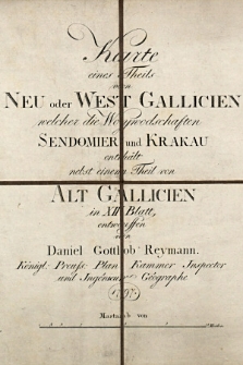
Title: Karte eines Theils von Neu oder West Gallicien welcher die Woywodschaften Sendomier und Krakau enthält nebst einem Theil von Alt Gallicien in XII Blatt : entworffen von Daniel Gottlob Reymann königl. preuss. Plan Kammer Inspector und Ingénieur Géographe
Publisher:
Place of publication/creation:
Description:
Scale:
Source:
Biblioteka Jagiellońska, 404 III Atlasy
Digital copy identifier:
NDIGKART001697 ; DIGKART000001
Coverage:
Language:
Rights:
Domena publiczna (public domain)
Location of original document:
Computer Catalogue:
Format:
Resource Identifier:
Sponsorship:
Object collections:
- Jagiellonian Digital Library > Type of library materials > Cartography > Maps
- Jagiellonian Digital Library > Projects > EFRR POIiŚ 11.1
Last modified:
May 9, 2023
In our library since:
Jul 14, 2010
Number of object content hits:
1 709
Number of object content views in DjVu format
347
All available object's versions:
https://www.jbc.bj.uj.edu.pl/publication/937
Show description in RDF format:
Show description in OAI-PMH format:
Objects Similar
Gołemberski, Władysław (1834-1891)
Dybiec, Julian (1940- ). Red. Meissner, Andrzej (1937- ). Red. Szmyd, Kazimierz. Red. Krawczyk, Jerzy (1953- ). Red.
Giermański, Piotr
Bobrzyński, Michał (1849-1935)
Gutwiński, Roman (1860-1932)
Zachariasiewicz, Stanisław (1891-1944). Red.